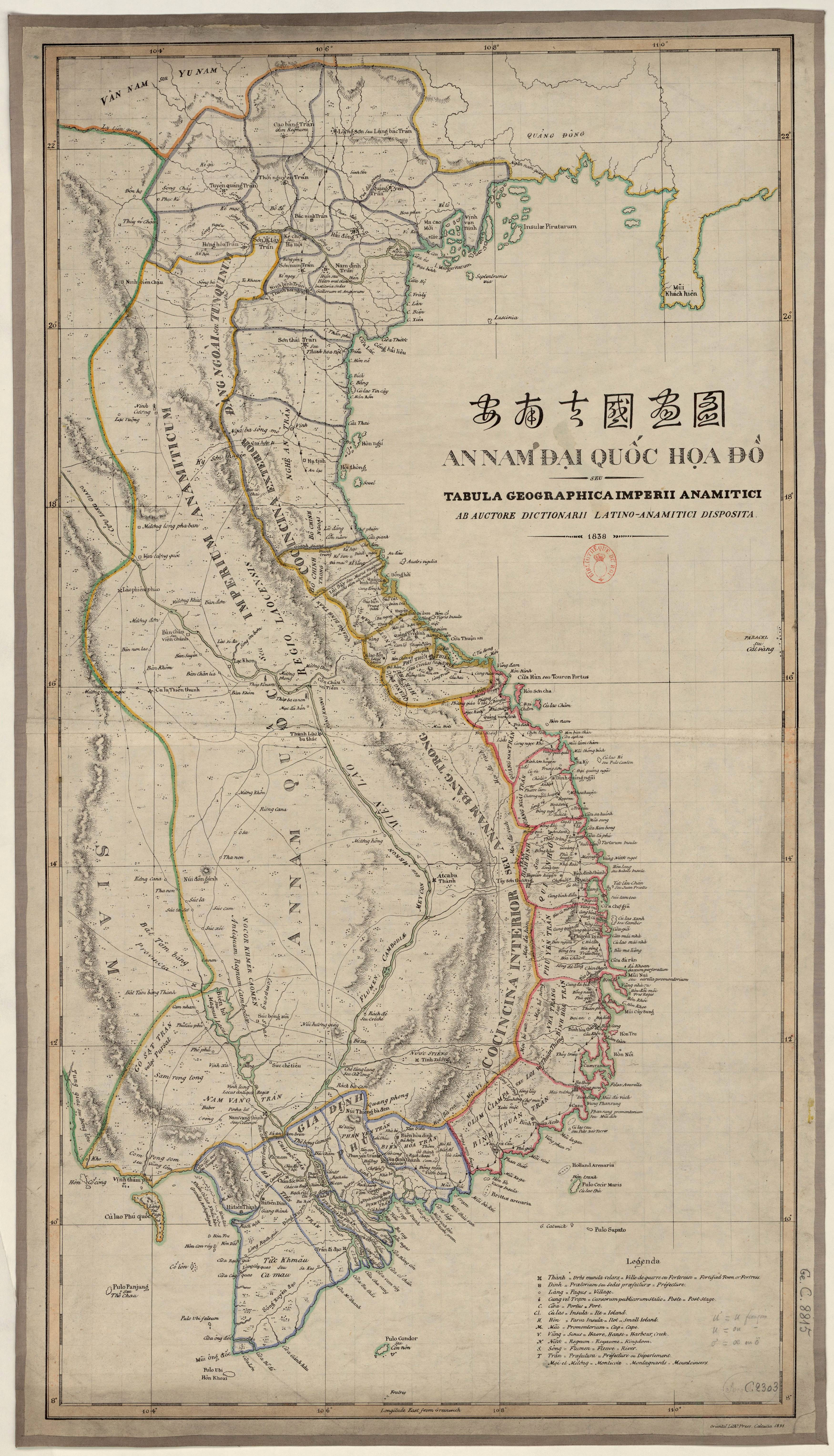

An Nam Dai Quoc Hoa Do - Geografica Imperii Anamiciti (the map of An Nam Empire)
The map of An Nam Empire drawn by Bishop Jean Louis Taberd, printed in the Latin - Annam dictionary published in 1838, size 84 x 45 cm. On this map, there is a drawing of the Paracel archipelago located in Viet Nam’s waters that has geographical coordinates nearly correct to reality, accompanied by the caption “Paracel seu Cat Vang” (Paracel means Golden Sand in Vietnamese).
The map of An Nam Empire has many special features such as annotating in 3 languages, being a special map of Viet Nam in the 19th century which proves Viet Nam's sovereignty over the Hoang Sa archipelago, and combining traditional Vietnamese cartography and Western cartography.
This map is currently archived at the French National Library.